


I have always enjoyed tinkering with microcontrollers and building small hands on projects that connect hardware with real world data. Recently I have been diving deeper into vibe coding projects where the focus is rapid creation, experimentation, and learning by doing rather than over engineering.
Many of my projects involve connecting sensors to microcontrollers and linking them to web APIs. I enjoy pulling live data from online sources and displaying it on small OLED screens or simple web servers that allow users to explore more information when they want. This approach makes it possible to turn raw data into something visual, useful, and engaging.
Building a Local Flight Tracker for Oxford Michigan
One of my most recent projects is a local flight tracker designed specifically for Oxford Michigan. I originally built this system as a safety tool for flying drones. Knowing which aircraft are nearby helps me fly responsibly and stay aware of low flying planes and helicopters. At the same time it has become an enjoyable way to monitor the air traffic passing overhead.
The first version of this flight tracker was created with the help of ChatGPT on a Sunday afternoon. ChatGPT provided a strong starting point for the overall code structure and logic, which allowed me to quickly get a working prototype. Over the next few days I refined the code, adjusted the data handling, and improved the interface to better match how I wanted the information displayed.

Designed to Work Within Free Flight Tracking APIs
A key design goal for this project was making sure it could run entirely on a free flight tracking API plan. To accomplish this, I programmed the system to update every twenty five seconds. This timing keeps the data accurate and responsive while minimizing API calls and avoiding the risk of running out of free credits.

This kind of constraint driven design is an important part of many microcontroller projects. It forces thoughtful decisions about how often data is needed and how it should be presented.
OLED Display and Web Based Flight Data
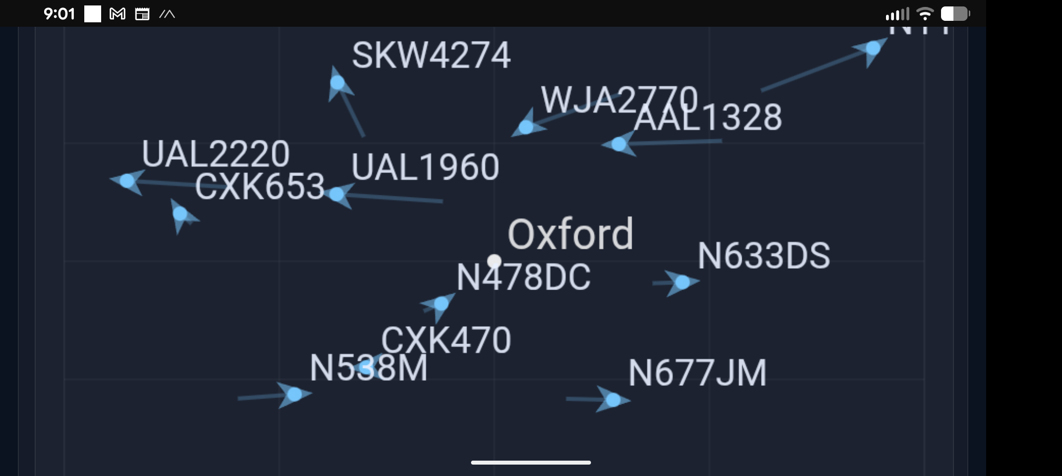
The OLED display connected to the microcontroller shows the closest aircraft currently flying near Oxford. Instead of presenting raw coordinates or complex charts, the display focuses on the number of flights near Oxford, the nearest aircraft’s callsign, direction it’s heading, altitude, speed, and distance and direction relative to Oxford. This allows the user to quickly look up and visually locate the aircraft in the sky.

For deeper insight, the system also hosts a lightweight web server. From there, users can view all detected aircraft in the area and click through to individual flight pages on FlightAware.com for more detailed information such as aircraft type, altitude, and route.

A Finished Project With Room to Grow
To complete the build, I 3D printed a custom enclosure for the Wemos ESP32 microcontroller which I downloaded for free. The finished device now sits in my home as both a practical aviation awareness tool and a fun piece of interactive technology.


There are many future updates planned, including further UI improvements and additional features, but this project is a good example of how quickly something useful can be built using vibe coding. With a bit of curiosity, accessible hardware, and a solid starting point from ChatGPT, it is possible to go from idea to working prototype in a very short amount of time. I also realized that if I left this webpage open in another tab while the microcontroller ran for a while, it would leave the flight paths drawn on the map. It was interesting to see the pattern of the flights above the town over the period of a few hours.